Fruit · Mulloon Creek, near Bungendore, NSW, Australia · 2006 to now
Mulloon Creek
Starting with 3 km of eroded creek in 2006, neighbours along Mulloon Creek are slowing and spreading water across a 23,000 hectare catchment.
a 23,000 hectare catchment
See it change from space
Google Earth Timelapse shows every year since 1984. Press play, and watch the land change.
The story
Mulloon Creek runs through farmland between Bungendore and Braidwood in the Southern Tablelands of New South Wales. The Mulloon Institute acknowledges the Yuin people as the Traditional Custodians of the land where its two properties are.
Like many Australian creeks after European farming, Mulloon Creek was badly eroded. In 2005 Tony Coote and his wife Toni invited Peter Andrews, founder of Natural Sequence Farming, to their farm. In 2006 works began on 3 km of the creek.
They built a series of living leaky weirs from rock and reeds, fenced out stock, and planted thousands of trees, shrubs, reeds and rushes. The aim was to slow the water, raise the creek level, spread floods and re-wet the floodplain.
The creek began to hold its flow in dry times, and neighbours joined. The Mulloon Rehydration Initiative now works with about 20 landholders across the catchment, with stream gauges, groundwater bores and satellite monitoring. In 2016 it was chosen as one of five model projects supported by the UN Sustainable Development Solutions Network.
How they did it
- Living leaky weirs of rock and reeds to slow the creek and raise its level
- Fencing to keep stock out of the creek
- Planting trees, shrubs, reeds and rushes along the banks
- Spreading floodwater back onto the floodplain
- Monitoring with stream gauges, groundwater bores and remote sensing
What changed
- Works began on 3 km of Mulloon Creek in 2006; the creek now keeps flowing in dry times, the Institute reports.[1]
- The initiative aims to cover 23,000 ha of Mulloon Creek and its main tributaries, with stream works on 16 properties by 2022.[2]
- Tony Coote reported a 60 percent rise in grazing productivity on his floodplain paddocks, which he put down to a higher water table.[4]
- Groundwater bores show rises in wet periods and slower falls in dry periods, and dry-season pasture growth is up 20 to 40 percent in rehydrated zones.[3]
- A benefit to cost ratio of at least 3.6 to 1 over 10 years for landholders.[3]
Who did it
Tony Coote AM (founder of the Mulloon Institute) and Toni Coote, Peter Andrews OAM, Peter Hazell, about 20 neighbouring landholders, the Southern Rivers Catchment Management Authority, Landcare groups, ANU researchers and First Nations knowledge holders. The Mulloon Institute acknowledges the Yuin people as the Traditional Custodians of the land where it works.
Worth knowing
Most results are reported by the Mulloon Institute, which runs and advocates for the work; the peer-reviewed paper so far describes the set-up and monitoring rather than final outcomes.
Peter Andrews' methods change watercourses and have been controversial, sometimes running into water law.
What we can take from it
- Slow the water first: a rehydrated creek can carry a farm through drought.
- One farm's demonstration can bring the neighbours in.
- Measure from the start, so others can trust the results.
Sources
- 1.Natural Sequence Farming pilot project · Mulloon Institute · Official
- 2.The Mulloon Rehydration Initiative: the project's establishment and monitoring framework (Peel et al. 2022) · Ecological Management and Restoration (ANU Research Portal) · Research
- 3.Australia: Mulloon Rehydration Initiative, investing in catchment-scale drought resilience · UNCCD Drought Toolbox · Report
- 4.UN eyes on Mulloon Creek (2016) · Farm Online · Story
- 5.Mulloon Creek tree planting (2022) · Mulloon Institute · Official
- 6.What we do · Mulloon Institute · Official
- 7.Mulloon · Wikipedia · Story
More places brought back
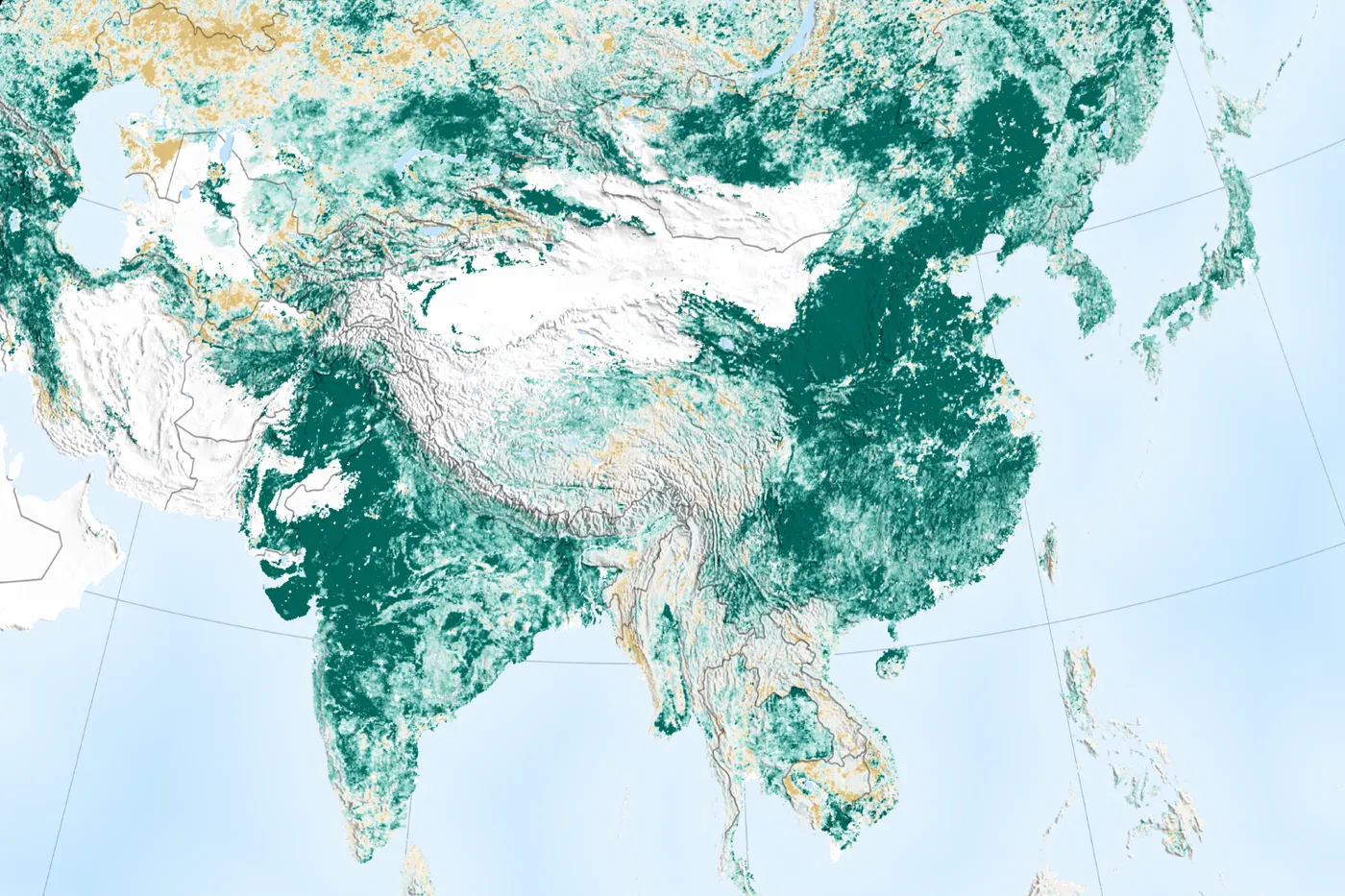
Shaanxi, Shanxi, Gansu and Inner Mongolia, China · 1994 to 2005 (and since)
Loess Plateau
about 35,000 km² in two World Bank projects
The Loess Plateau had one of the highest erosion rates in the world. From 1994, farming families built terraces and small dams, stopped free grazing and replanted the slopes. Vegetation cover doubled, incomes doubled and the Yellow River carries far less soil.
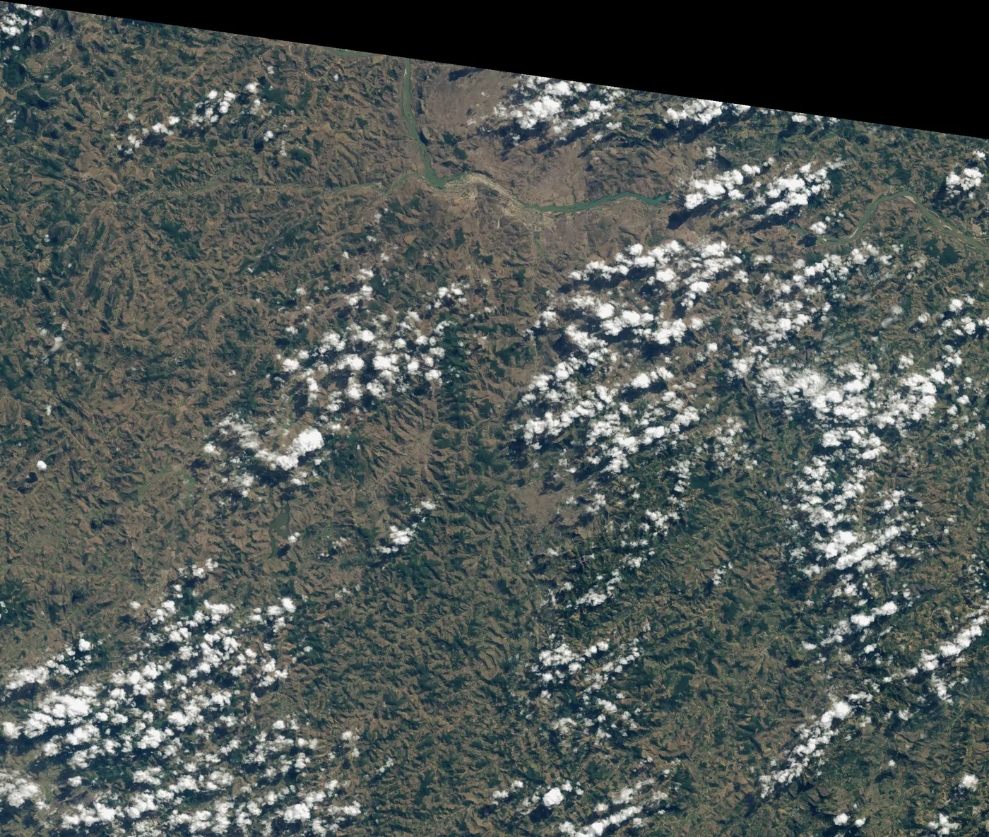
Fazenda Bulcão, Aimorés, Minas Gerais, Brazil · 1998 to now
Instituto Terra
608 hectares of Atlantic Forest
When the Salgados came home to Aimorés in the 1990s, the family farm was bare and eroded. Lélia suggested they plant the forest back. Two decades on, the hills are forested, many species have returned and dry streams flow again.
Maradi and Zinder regions, southern Niger · 1983 to now
Niger's farmer-managed regreening
about 5 million hectares
After the droughts of the 1970s and 1980s, southern Niger's farmland was nearly bare. Farmers began protecting the shoots of living tree stumps in their fields. The trees came back across millions of hectares, at very low cost.