Fruto · Hangjin Qi, Ordos, Inner Mongolia, China · 1988 hasta hoy
Desierto de Kubuqi
Desde una salina en 1988, una empresa, pastores locales y el gobierno sembraron árboles, arbustos y pastos en más de 5.000 km² del desierto de Kubuqi.
más de 5.000 km² sembrados
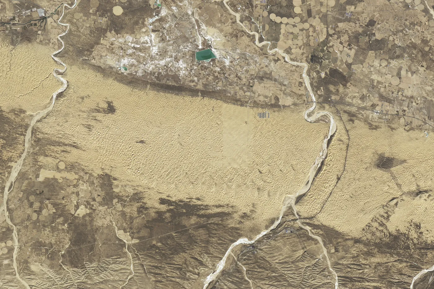
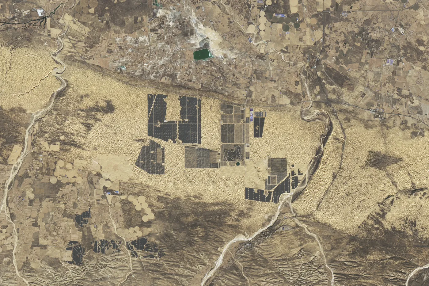
Míralo cambiar desde el espacio
Google Earth Timelapse muestra cada año desde 1984. Dale play y mira cómo cambia la tierra.
La historia
The Kubuqi Desert runs about 400 km along the south bank of the Yellow River. Centuries of grazing had stripped the land, and sand buried roads and threatened the salt works in the middle of the desert.
In 1988 Wang Wenbiao, manager of the salt works, put 5 yuan from every tonne of salt into tree planting and assigned 27 workers to plant. A 65 km highway to the railway kept getting buried, so the team protected it with shelterbelts and chequerboard plantings.
The work grew into the Kubuqi Ecological Restoration Project of Elion Resources Group, with local governments and national desert-control programmes. A shelterbelt 242 km long now runs along the Yellow River. Local households were encouraged to grow liquorice, and Elion supplied seeds and training and bought the harvest at a fair price.
UNEP reviewed the project in 2015 and found fewer dust storms and a greening trend in satellite data. In 2017 Wang Wenbiao received a UNEP Champions of the Earth award for lifetime achievement. Today the desert edge is also becoming a giant solar farm.
Cómo lo hicieron
- Shelterbelts and chequerboard plantings to hold moving sand along roads
- Fenced, closed areas so plants could establish
- Drought-tolerant shrubs and grasses grown on rainfall, trees only where groundwater is close
- Liquorice and herb farming with local households, with Elion buying the harvest
- Irrigation from deep groundwater and stored Yellow River flood water
Qué cambió
- More than 5,000 km² planted with trees, shrubs and grasses since 1988.[1]
- A shelterbelt 242 km long and 5 to 20 km wide along the Yellow River.[1]
- Strong evidence that dust storms in Hangjin Qi became less frequent and less severe.[1]
- UNEP's model estimated a net benefit of US$1.8 billion over 50 years, with a 12 percent chance of a loss.[1]
- UNEP’s 2017 award citation says around two-thirds of the desert has been greened; a later UNEP story puts it at about a third.[2]
Quiénes lo hicieron
Wang Wenbiao and Elion Resources Group led it, with the Hangjin Qi and Ordos governments, national desert-control programmes, and local farmers and herders who planted, worked and grew liquorice.
Bueno saberlo
This is state-backed and company-led, and UNEP's review was made with Elion's cooperation. The project also serves Elion's businesses.
UNEP found no water table measurements in the project area; local residents said the water table had dropped slightly where it was near the surface. Rainfall alone cannot keep trees alive there.
Scientists have warned that relying too much on tree planting in China's drylands can dry out soils and worsen water shortages.
Lo que podemos aprender
- Match plants to the water: shrubs and grasses on rain, trees only where groundwater is near.
- Pay local people for the work and buy what they grow.
- Monitor groundwater from the start, so success does not quietly use up the aquifer.
Fuentes
- 1.Review of the Kubuqi Ecological Restoration Project: A Desert Green Economy Pilot Initiative (2015) · UNEP · Informe
- 2.Wang Wenbiao: Lifetime Achievement, Champions of the Earth 2017 · UNEP · Oficial
- 3.Wang Wenbiao: Son of the desert with a mission to green the planet · UNEP · Historia
- 4.Building a Great Solar Wall in China · NASA Earth Observatory · Satélite
- 5.Kubuqi desert restoration project · European Space Agency · Satélite
- 6.Excessive reliance on afforestation in China's arid and semi-arid regions: lessons in ecological restoration (Cao et al. 2011) · Earth-Science Reviews · Investigación
Más lugares que volvieron a la vida
Shaanxi, Shanxi, Gansu and Inner Mongolia, China · 1994 a 2005 (y desde entonces)
Meseta de Loess
unos 35.000 km² en dos proyectos del Banco Mundial
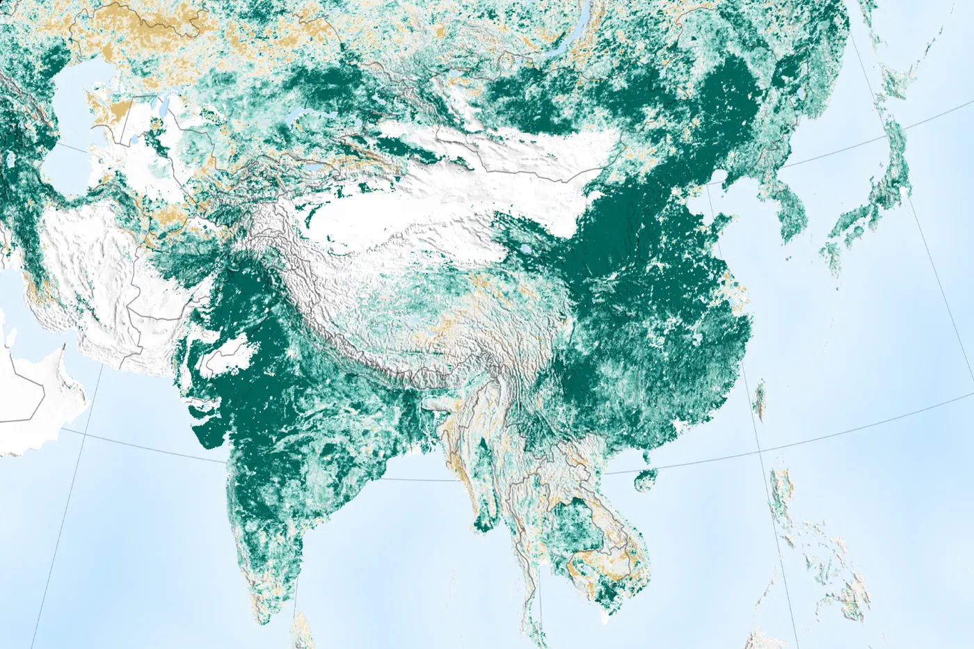
La Meseta de Loess tenía una de las tasas de erosión más altas del mundo. Desde 1994, las familias campesinas construyeron terrazas y pequeñas represas, dejaron de pastorear libremente y volvieron a sembrar las laderas. La cobertura vegetal se duplicó, los ingresos se duplicaron y el río Amarillo arrastra mucho menos suelo.
Fazenda Bulcão, Aimorés, Minas Gerais, Brazil · 1998 hasta hoy
Instituto Terra
608 hectáreas de Mata Atlántica
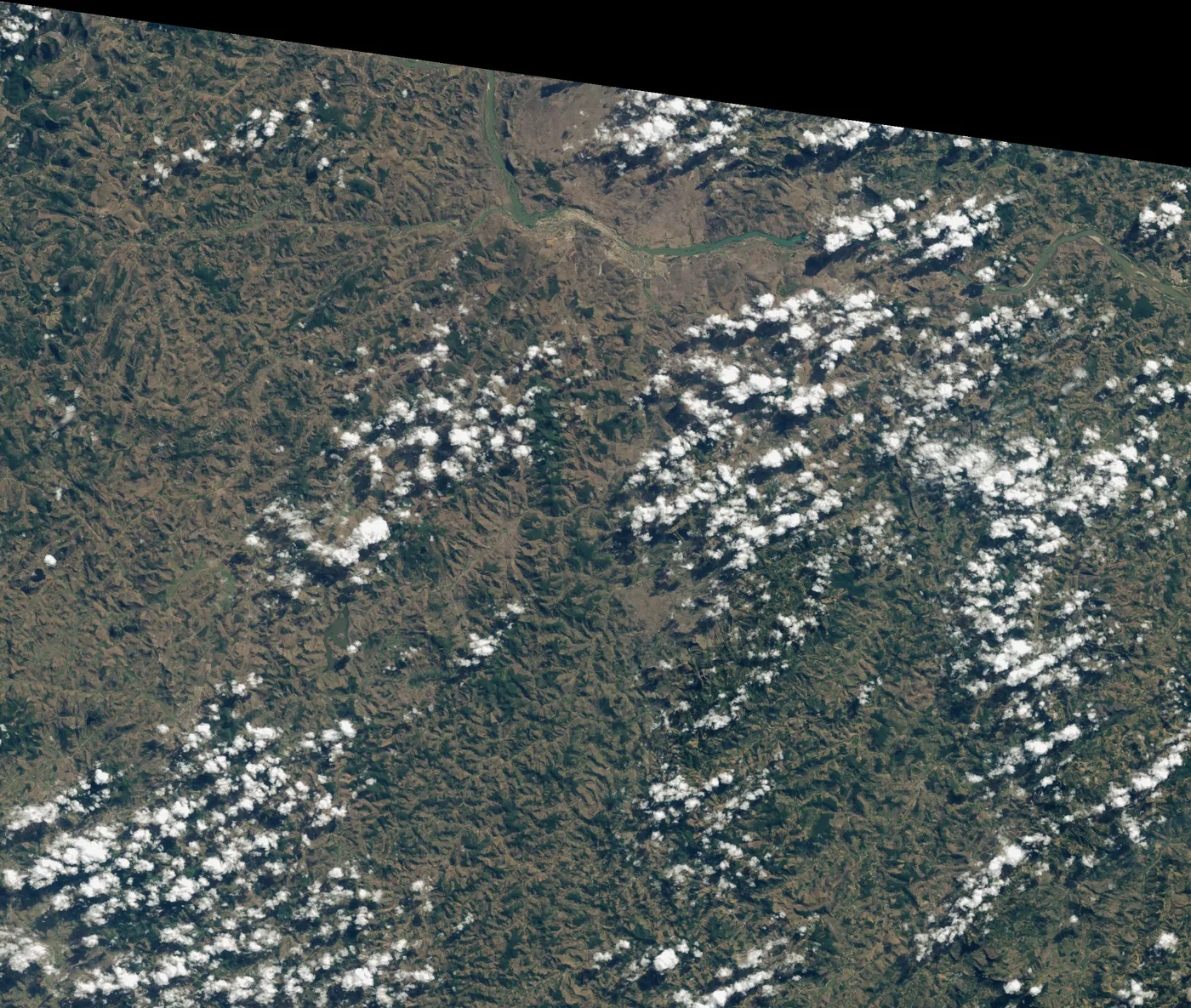
Cuando los Salgado volvieron a Aimorés en los años noventa, la finca familiar estaba pelada y erosionada. Lélia propuso volver a sembrar el bosque. Dos décadas después, las colinas tienen bosque, muchas especies han vuelto y los arroyos secos corren de nuevo.
Maradi and Zinder regions, southern Niger · 1983 hasta hoy
El reverdecer de Níger en manos campesinas
unos 5 millones de hectáreas
Tras las sequías de los años setenta y ochenta, las tierras de cultivo del sur de Níger estaban casi desnudas. Los agricultores empezaron a proteger los brotes de los tocones vivos en sus campos. Los árboles volvieron en millones de hectáreas, a muy bajo costo.